The app every drone pilot needs.
From planning to post-flight: regulation, operational risk, airspace, weather, GNSS, documents, insurance and artificial intelligence in one ecosystem.
- Specialized AIC
- ARO in the app
- Collaborative map
- Flight intelligence
Not just another drone app. Your operations hub.
Takeoff Max connects decisions that are usually scattered across websites, PDFs, groups, spreadsheets and memory. Each feature is designed to reduce friction and add context before takeoff.
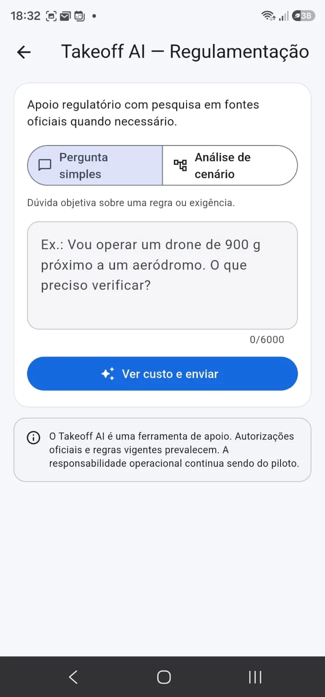
AIC: an artificial intelligence consultant in your pocket
AIC means Artificial Intelligence Consultant. Instead of a generic AI, Takeoff Max creates specialized consultants for each mission: regulation, RETA insurance, ARO and new domains that will join the ecosystem.
- Regulatory AIC for operational questions and scenarios
- RETA AIC to guide the insurance journey
- ARO AIC to support risk assessment
- Context-aware answers with official references when applicable
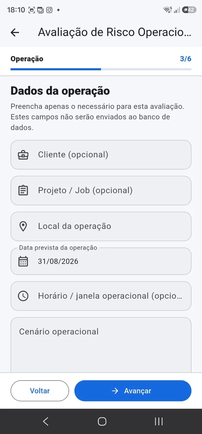
Build your ARO simply, quickly and completely
Operational Risk Assessment no longer needs to feel intimidating. The app guides the operation step by step and organizes the necessary information. FREE already includes 1 ARO per month.
- FREE: 1 ARO per month
- PREMIUM: up to 10 ARO per month
- MAX: up to 20 ARO per month
- Guided flow with ARO AIC support
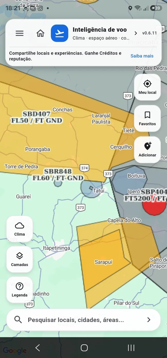
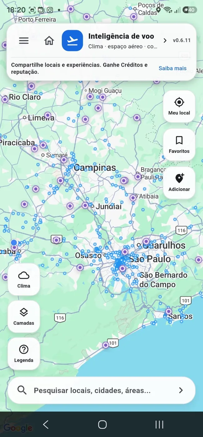
A map that answers questions ordinary maps cannot
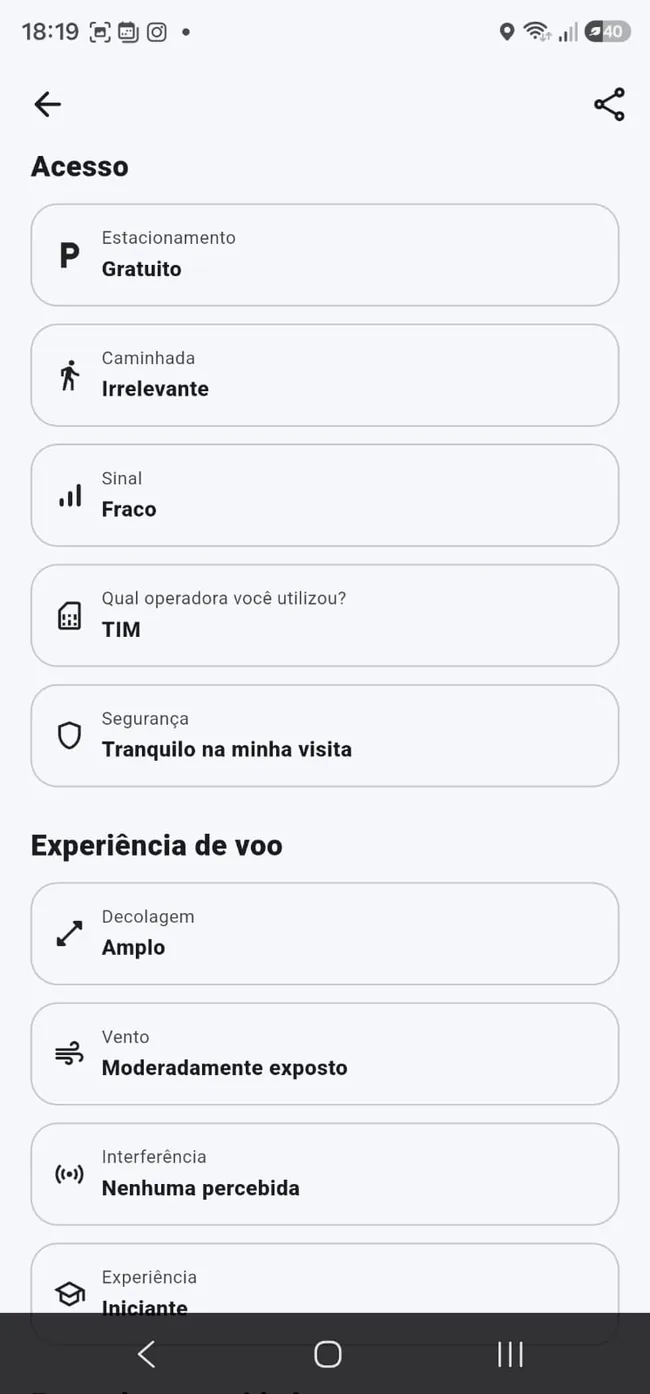
Beyond aviation and weather layers, the community records what it is actually like to fly at a place: access, safety, parking, walking, signal, wind exposure, interference, required experience, infrastructure, best filming time and much more.
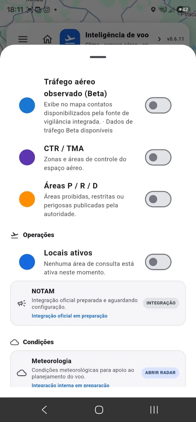
- Aerodromes, heliports, CTR/TMA and P/R/D areas
- Temperature, wind, rain and cloud layers
- Collaborative places with access, safety, signal and infrastructure
- Photos, ratings, questions and community confirmations
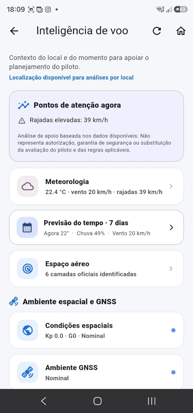
Flight intelligence: weather + airspace + GNSS + space weather
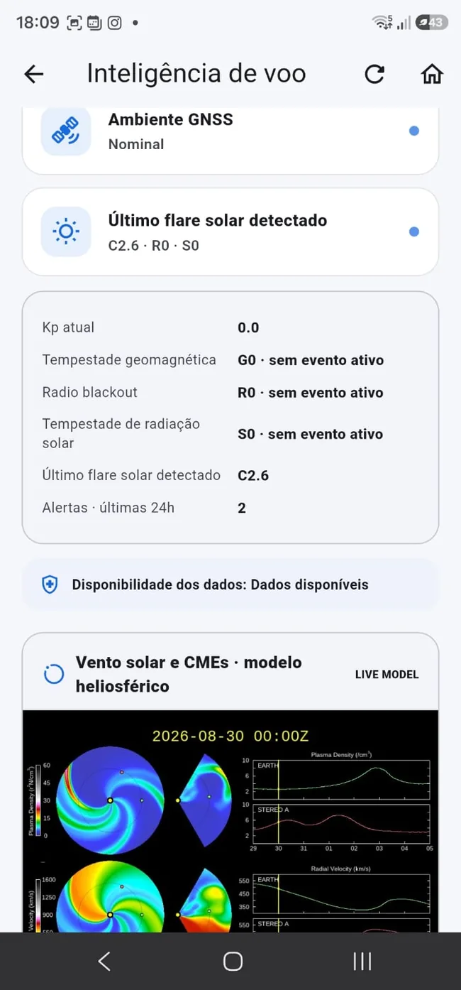
Wind, rain, temperature and clouds are only the beginning. Takeoff Max also contextualizes Kp index, geomagnetic storms, solar flares, radio blackout, solar radiation, solar wind/CME and GNSS environment.
- Wind, gusts, rain, temperature and clouds
- Kp index and geomagnetic environment
- Radio blackout, solar radiation and solar flares
- Solar wind, CME and GNSS environment context
RETA insurance without turning the process into bureaucracy
Use the RETA AIC, understand the process and move toward contracting with exclusive conditions inside the ecosystem. Clear information before you buy and a much more direct journey.
There is much more inside Takeoff Max
The value is in the system: each module speaks to the pilot’s real workflow and builds a more complete professional ecosystem.
Specialized AI consultants
Regulation, RETA, ARO and new domain-specific consultants.
Learn more → AROOperational Risk Assessment
Guided workflow for a complete ARO. FREE: 1/month; PREMIUM: 10/month; MAX: 20/month.
Learn more → MAPCollaborative map
Places, access, safety, experience, photos, ratings and dozens of community signals.
Learn more → FLIGHTFlight intelligence
Weather, airspace, GNSS and space weather in an operational view.
Learn more → RETARETA insurance
Guidance and contracting with exclusive conditions.
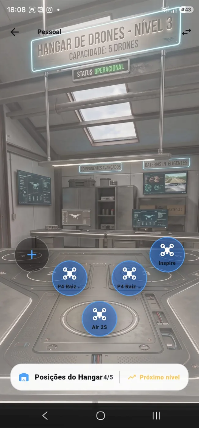
Learn more → HANGARPersonal & company hangar
Fleet, documents and professional links organized.
Learn more → DOCSDocuments
Certificates, codes and important documents in one place.
Learn more → CHECKChecklists
Pre-flight, post-flight and custom lists on compatible plans.
Learn more → FAVFavorite locations
Save points of interest and check conditions by location.
Learn more → BIZCompanies
Register company, fleet and professionals who can use company drones.
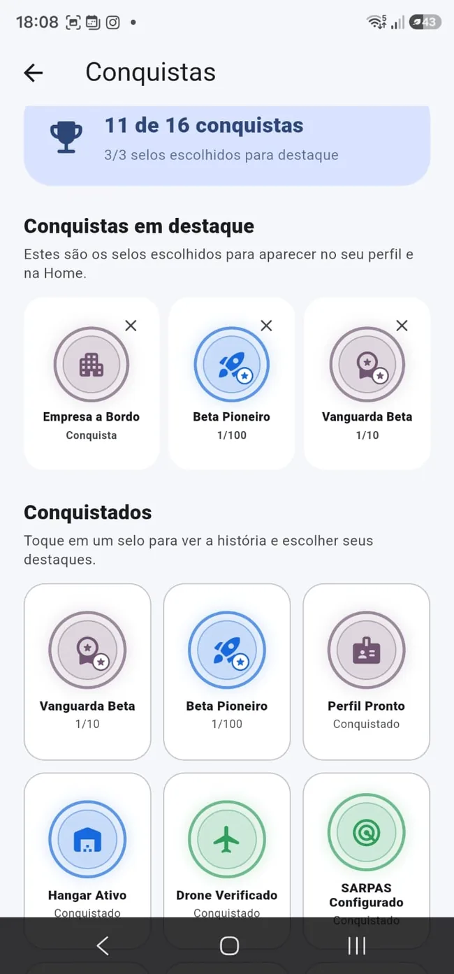
Learn more → ACHIEVEAchievements & reputation
Turn participation and progress into credibility.
Learn more → TOFFTOFF
Balance for AIC and ecosystem resources, with permanent bonuses and monthly promotional allowances.
Learn more →One app. Multiple important decisions in one place.
Your flight starts long before takeoff.
It starts when you understand the scenario, organize the operation and make decisions with context. That is exactly where Takeoff Max fits.
Get the launch offerJoin the launch
Get Takeoff Max launch news and special launch conditions.