
See the airspace. Then learn what flying there is really like.
Takeoff Max combines technical layers with collective intelligence: what exists in the sky and what a pilot needs to know when arriving on the ground.
From base maps to aviation and weather context
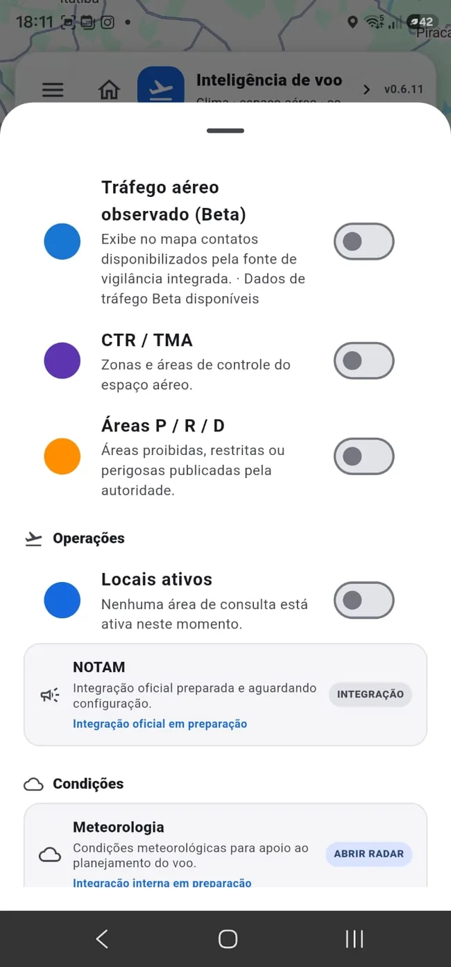
Switch between standard, satellite, hybrid and terrain views and add technical layers as needed. Advanced integrations can be labeled Beta while they mature.
- Aerodromes, runways and heliports
- CTR/TMA and Prohibited, Restricted and Danger areas (P/R/D)
- Temperature, wind, rain and clouds
- Community places and shared flights
- Observed traffic and other integrations when available/Beta
What an official map cannot tell you
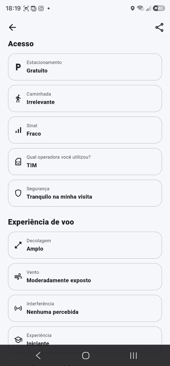
Community contributions can describe the operational reality of a place: access, parking, walking, signal, safety, wind exposure, interference, infrastructure and recommended experience.
- Days and hours
- Best time for filming
- People flow and public/private property
- Access, parking and walking
- Signal, safety, takeoff area, wind and interference
- Photos, questions, ratings and confirmations
Save places and check conditions
Favorites turn map points into a lightweight operational shortlist.
- FREE: up to 2 favorites
- PREMIUM: up to 10 favorites
- MAX: up to 30 favorites
- Location conditions in the same journey
Frequently asked questions
Does the map replace official sources or approvals?
No. It adds context, but pilots must confirm official requirements and real-world conditions.
Is community information verified?
The product supports ratings, confirmations, questions and incorrect-information reports. Collaborative data can still change and should be verified for critical decisions.
Which layers are available?
The set evolves. It includes base maps, community, aerodromes/heliports, airspace and weather; Beta resources are identified in the app.
Join the launch
Get Takeoff Max launch news and special launch conditions.